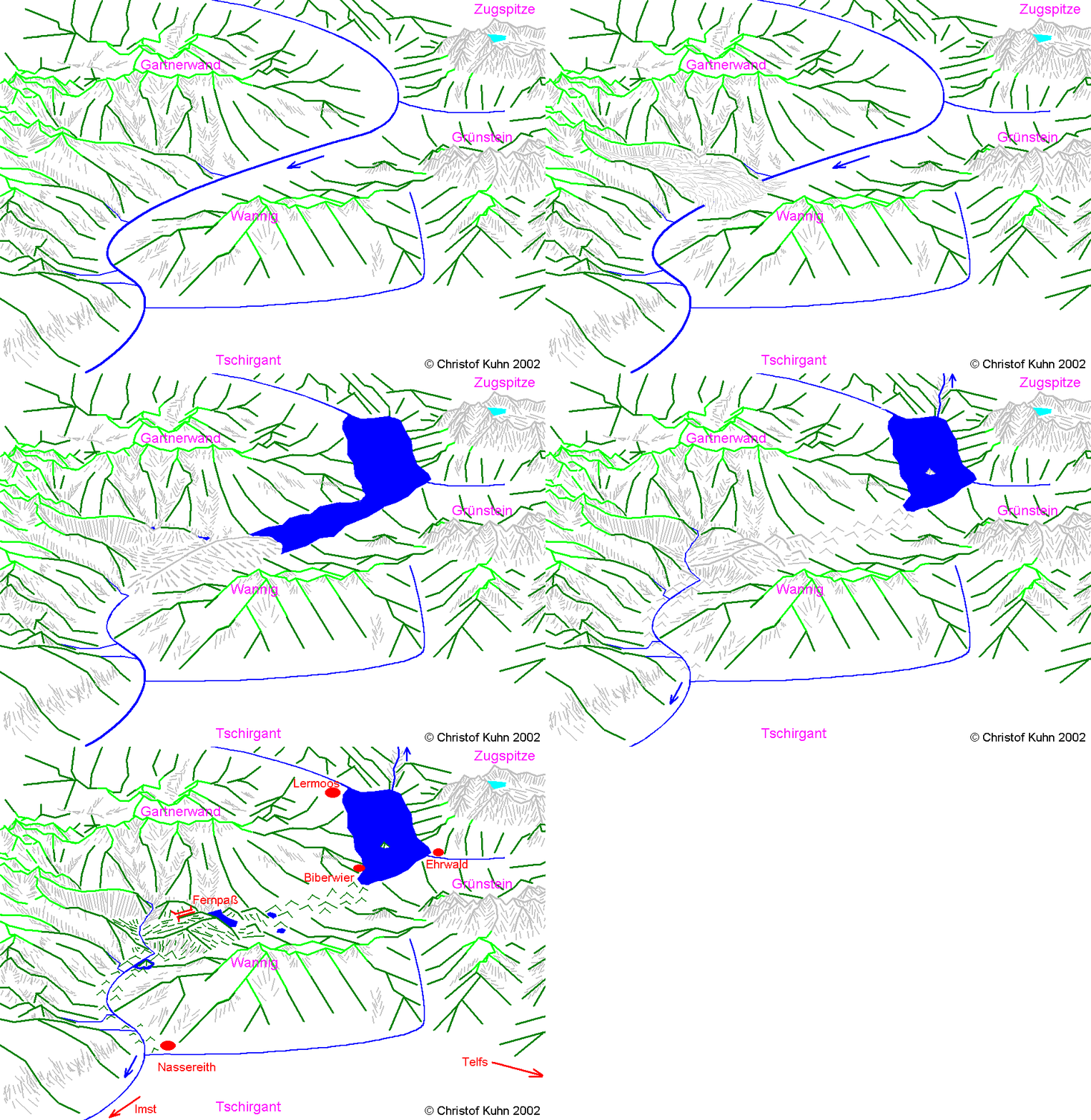

Attempt of reconstructing the Fernpass landslide. View to the North.
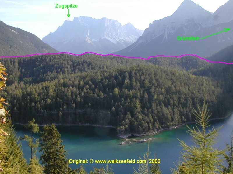
View from Fernpass to Northeast above the "Blind Lake" (there is no outflow above ground). All the area below the pink line is landslide material!
Original image kindly provided by www.walkseefeld.com,
adapted by Christof Kuhn (2003).
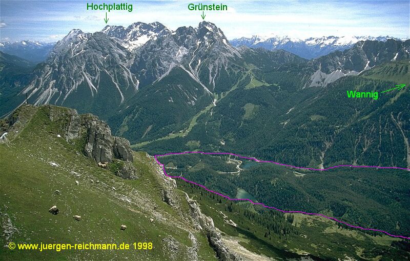
View from Grubigstein peak (E of Gartnerwand) to East. All the area within the pink line is landslide material!
Original image kindly provided by www.juergen-reichmann.de,
adapted by Christof Kuhn (2003).
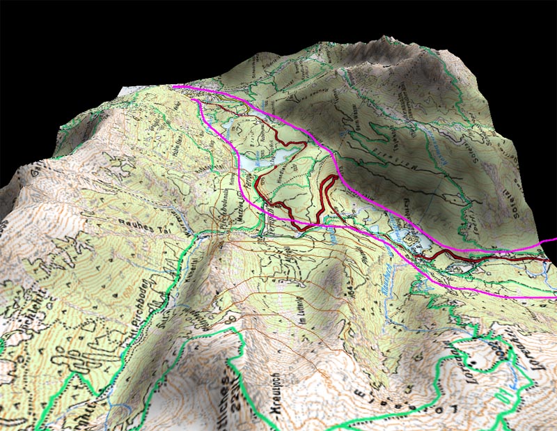
The eastern slope of Kreuzjoch Peak (reconstructed contour lines brown) slid into what was once a wide valley (wasted mass pink).
Picture taken from AustrianMap 2.0, edited by Christof Kuhn (2005).
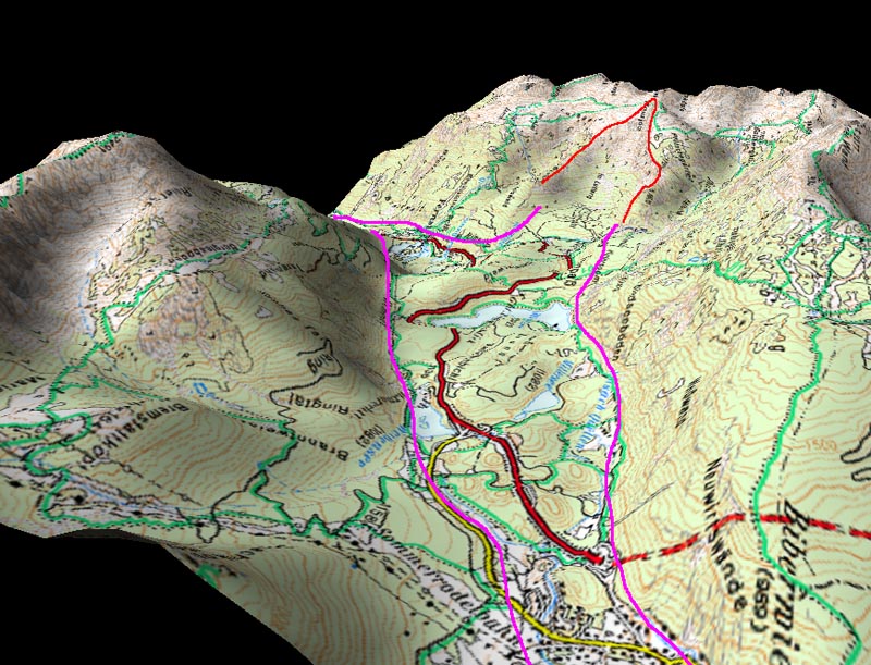
Frontal view of the removed slope (red boundary) and the wasted mass (pink), that slid far beyond Bieberwier (at the right).
Picture taken from AustrianMap 2.0, edited by Christof Kuhn (2005).
Also see Alp-S Project
 Back
BackResponsible for the content:
Christof Kuhn office@geol-info.at
Last modified: April 11, 2006